

“Ye teesra sheher hai,” Haji Umer Sholani Baloch quipped, watching the Indus’ floodwaters push past Kotri barrage and spill into the sea in Keti Bunder. A native son of this sinking coastline, Umer’s offhand remark captures the tragedy that has unfolded here: entire settlements swallowed, rebuilt, and swallowed again as sea intrusion becomes an unrelenting fact of life.
His words carry an unspoken warning: the Arabian Sea is advancing. And in this fragile delta at the tail-end of the Indus Basin Irrigation System, it has already forced whole communities to uproot and retreat.

Keti Bunder, a once bustling seaport that lies in Thatta district, was once the glittering capital of Sindh. Historical accounts place Thatta at the centre of power from the 14th to 16th centuries, until the arrival of the Mughals. The late Ghulam Mohammad Lakho, who headed Sindh University’s history department, once told me that Thatta served as the capital under the Soomro and Samma dynasties (1335–1520), and remained a port city well into the 18th century. He often quoted the Persian author Mir Tahir Nasyani, who wrote: “The people of Thatta never experienced hunger when it basked in economic prosperity.”
Umer Baloch, too, grew up on stories of a thriving Keti Bunder. It was the same historical memory that resurfaced during the Musharraf era, when then-chief minister Dr Arbab Ghulam Rahim proposed reviving Keti Bunder as Sindh’s third seaport. But today, the town faces a different fate including collapsing farmlands, migration, and the slow violence of a sea inching inland.

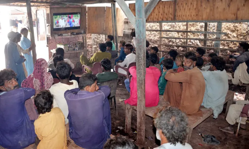
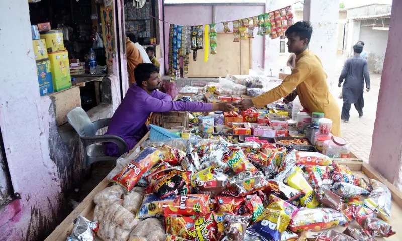
“The city was known for its rich agricultural landscape,” Umer tells me from behind the counter of his small grocery shop, lit only by a solar panel because electricity is unreliable here. Like many residents of Keti Bunder, he has turned to the sun for power.
The turning point came as the Indus began to thin. Freshwater flows declined, and the sea began to eat its way in. “Sheher iss se pehle aagay hota tha,” he explained, recalling that the town used to lie further ahead. Entire communities, their homes and their businesses, have been pushed inland repeatedly by sea intrusion, forcing them to rebuild their lives on shrinking land.
The conversation is joined by Ghulam Hyder Channa, a small farmer who grows vegetables and cultivates paddy. “The destruction of our region actually began after 1964,” he said. “We once received freshwater throughout the year.”

Wheat, sugar cane, bananas, and the famed varieties of red rice were once staples of undivided Thatta’s fields. But as river flows dwindled, and floodwaters became rare, arriving now only during the monsoon or extreme climate events (like the ones recorded in 2025), the entire landscape transformed.
Channa noted that a rice factory operated in Keti Bunder until 1955 — a reminder that this was once a region dominated by rice cultivation, a water-intensive crop. Today, such mills have largely shifted to upper Sindh or to traditional rice belts like Tando Mohammad Khan.
A port town being undone
“We are living through a crisis,” Hyder lamented. “Imagine the prosperity of a place where people once had enough to offer milk as a soft drink.” Fifty years ago, he added, massive river flows posed the biggest challenge to those living along the banks. “Now it is saline seawater that is swallowing our land.”
Even the road leading into Keti Bunder, he said, acts like an informal dyke. “Water used to stay three to four feet below the road. Now it touches the edges twice a day, rising and falling with the sea.”
Keti Bunder taluka (an administrative unit comprising a number of villages) comprises 31 revenue Dehs. Of these, official figures show that 114,208.32 acres are now under the sea. Collectively, 170,199.39 acres out of 212,752.24 acres across Thatta’s three talukas — Keti Bunder, Mirpur Sakro, and Ghora Bari — have fallen prey to an ever-advancing sea.
Sujawal district mirrors this decline. It also has three talukas: Kharochhan, Shah Bunder, and Jati. According to revenue records, 85 of its 257 Dehs have been overtaken by the sea.
In Kharochhan alone, 400,000 acres out of 595,091 acres (29 of 32 Dehs, or 67 per cent), are under water. In Shah Bunder, 518,895 acres out of 735,706 acres (43 of 92 Dehs, or 46pc) have been lost. Jati taluka fares no better: 405,000 acres out of 879,373 acres (47pc of its land, spread across 13 of 133 Dehs) now lie beneath seawater.
These are not just disappearing revenue units on paper. Each submerged Deh represents uprooted families, forced relocations, and the erosion of entire coastal communities along with their livestock (their only sources of livelihood). Over the years, this encroaching seawater has also contributed to a steep decline in the Indus Delta’s mangrove forests.
“I remember people cultivating red rice in Deh Shahpur Dhakan Wari in the Keti Bunder area. We had to move to Deh Doolho Chholani in 1999 after the catastrophic cyclone,” recalled 70-year-old Haji Mohammad Murugur. “It wasn’t just red rice, even gidra (watermelon) was grown here back then.”
His community member, Fateh Baloch, believed the road connecting Kharochhan once served as a natural dyke. “Without it, the groundwater turned brackish because of sea intrusion into the aquifer,” he said. The advancing seawater, he added, ultimately forced their caste fellows to abandon their homes in Deh Shahpur Dhakan Wari and shift to Deh Doolho Chholani.
Until recently, residents of Keti Bunder relied almost entirely on tanker-supplied drinking water. Relief came only after the intervention of the area’s Sindh Assembly member, Haji Ali Hassan Zardari, regarded as a powerful minister due to his proximity to the sitting president, who initiated a long-delayed piped water project.

“We are getting water supply now,” said Abdul Wahid Memon, chairman of the Keti Bunder union council. He explained that the previous supply line had long been damaged. “Sea intrusion is the main reason the network keeps collapsing. The seawater cuts through the land, creating small creeks and destroying the pipeline. The original line was laid during Zulfikar Ali Bhutto’s era,” he said, referring to the PPP founder who contested elections from this region in the 1970s.
According to Wahid, drinking water had become an unaffordable luxury for many households until recently. “As the sea kept advancing, the pipelines corroded and became unusable, so a completely new network had to be installed,” he stated. Water storage ponds have now been rebuilt, and he claimed that “regular supplies are finally reaching every household in Keti Bunder.”
The delta that’s slipping away
Mangrove forests have long been an essential part of Pakistan’s coastal belt, but their decline over the past couple of decades has been stark. In recent years, however, large-scale replantation efforts under various Sindh government initiatives have begun to reverse this trend. These projects have not only revitalised degraded ecosystems but also enabled the government to tap into the global carbon credit market. So far, they have generated around $40 million in carbon credit sales, with projections indicating even greater revenue in the years ahead.
Experts such as Naseer Memon, a consultant on climate change-induced natural disasters who has written extensively on Sindh’s water crises, trace the delta’s ecological collapse to the decline in sustainable flows during the kharif season and to upstream Indus projects that have diverted critical freshwater away from the delta.
“In the past, the Indus would experience a low flood annually and a medium flood every third year. That pattern sustained the delta,” he explained. “But those flows have now drastically diminished.” As a result, estuaries and creeks have begun shrinking, undermining ecosystems and accelerating mangrove loss. “It was the post-Tarbela era, I believe, that set the stage for irreversible damage. The degradation reached its peak over the next 40 to 50 years,” he noted.
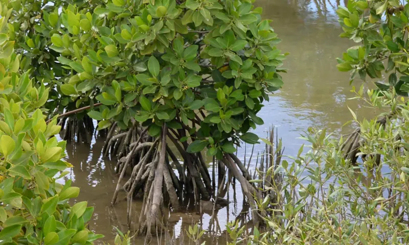
An estuary is the wide part of a river where its waters meet the sea, creating mudflats formed by the silt the Indus carries. When the river once brought historic volumes of water, mangroves flourished. But as those flows reduced, so did the mangroves. “These muddy lands are the natural home of mangroves in the river’s estuary. This process is becoming increasingly rare, with only a handful of creeks still receiving enough Indus water to carry it out to sea. That is why the government’s recent carbon-credit project has been launched in a very limited area,” Naseer explained.
He cautioned that we must not lose sight of the mushrooming housing societies and widespread land reclamation along Karachi’s coast. This unchecked infrastructure boom has resulted in bulldozed mangrove belts, while the city’s polluted industrial discharges into the sea have become a major driver of their degradation.
Still, he viewed the Sindh government’s carbon-credit initiative as a step in the right direction, given the rapid decline of green cover in the delta. “We must scale this up, even if the world is still debating it,” he said. To him, it is a model worth replicating in clean energy too as it is an area where Sindh has significant potential.
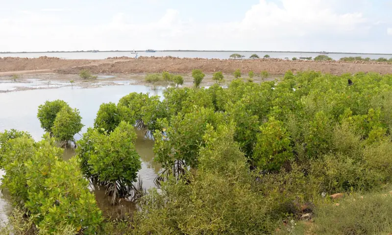
According to the Sindh Forest Department, four species of mangroves survive in the Indus delta — about 90pc are Avicennia marina, with much smaller shares of Rhizophora mucronata, Aegiceras corniculatum, and Ceriops tagal. Of the delta’s roughly 600,000 hectares, the Forest Department administers 280,470ha (693,000 acres), Port Qasim Authority oversees 64,400ha (159,000 acres), and the Sindh Board of Revenue controls 255,130ha (630,000 acres).
The department acknowledged that the delta’s mangrove ecosystem has been severely degraded in recent years driven by rising coastal populations, overexploitation of resources, industrial pollution, and, above all, the acute shortage of freshwater as the Indus is diverted inland for agriculture. Historically, abundant freshwater and nutrient-rich sediment fuelled a thriving ecosystem. But as the river’s discharge has steadily reduced, the sediment supply to the mangroves has fallen with it, eroding the ecological foundation of the Indus delta itself.
But beyond the environmental strain, an equally striking change has emerged in the way this coastal town keeps its lights on. Keti Bunder is perhaps the only town in Sindh that has effectively bid farewell to the conventional electricity grid.
“We are no longer dependent on traditional power supply from the utility,” said Wahid, referring to the Hyderabad Electric Supply Company (Hesco) network. “In fact, Hesco staff removed the transformers in our area during Imran Khan’s government because of outstanding dues,” he recalled.
In the aftermath, residents collectively shifted to solar energy. “Now almost every household in Keti Bunder runs on solar power,” he said. The town’s relatively mild temperatures, moderated by coastal winds even in peak summer, mean that air conditioners are rare, allowing solar systems to meet daily needs comfortably.
A rare reprieve for Pakistan’s mangroves
The International Union for Conservation of Nature (IUCN) launched its report, Assessment of Mangroves in Pakistan, at the 29th Conference of the Parties to the United Nations Framework Convention on Climate Change (COP29) in Baku, Azerbaijan, in November 2024.
The report’s summary stated that it documents changeed in Pakistan’s mangrove cover from 1980 (the baseline year) to the present. It noted that mangroves were heavily exploited in the past for fuelwood, timber and animal fodder. The construction of irrigation structures on the Indus River, particularly the Kotri Barrage in 1955, had major negative environmental impacts on mangroves due to the drastic reduction in freshwater and fine sediment flows reaching the lower Indus delta.
According to the IUCN report, the first large-scale mangrove rehabilitation efforts began in the 1990s, when 17,100 hectares of mangroves were planted in the delta under a World Bank–supported project using propagules brought from Miani Hor. Continuing mangrove rehabilitation and afforestation efforts have since led to a remarkable increase in mangrove cover, by roughly 300pc in less than 30 years, in both Sindh and Balochistan. The latest mangrove area data indicate that cover increased to at least 285,000ha in 2022, with projections suggesting a total of up to 345,000ha by 2027–2030.
The 2025 monsoon season, now at its end, brought intense flooding to the upper regions, particularly Punjab. However, for the Indus Delta, this deluge carried an unexpected reprieve. Downstream flows at Kotri remained unusually robust, according to an irrigation official, with nearly 30 million acre-feet of water surging past the barrage between April and September, driven by swollen eastern rivers.
As this lifeline finally reached the sea, it rekindled hope across fishing communities from Kotri to Thatta, where livelihoods are tethered to the river’s pulse. For many, the return of the palla fish was simply evidence of what steady flows can restore.
And yet, this may be too little, too late for Haji Umer and the hundreds of thousands like him who have seen this cycle repeat time and again for at least the last five decades. What Keti Bunder needs is a holistic plan for its revival — one that involves steady river flows all-year round, but which appears increasingly unrealistic given the sporadic nature of the water flows courtesy a combination of climate change and bad infrastructure development.
Header image: A wooden boat pulls up at the Indus River’s edge at Dandoo jetty in Keti Bunder after a long journey, as fishermen transfer their catch onto a vehicle bound for Karachi’s fisheries.
Note: All images in the article are provided by the author.


